Parco Della Murgia Materana
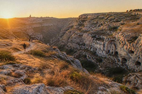
The Parco della Murgia Materana is the protected plateau of caves and rock churches that faces the Sassi of Matera across the Gravina canyon in Basilicata, southern Italy.
Short answer
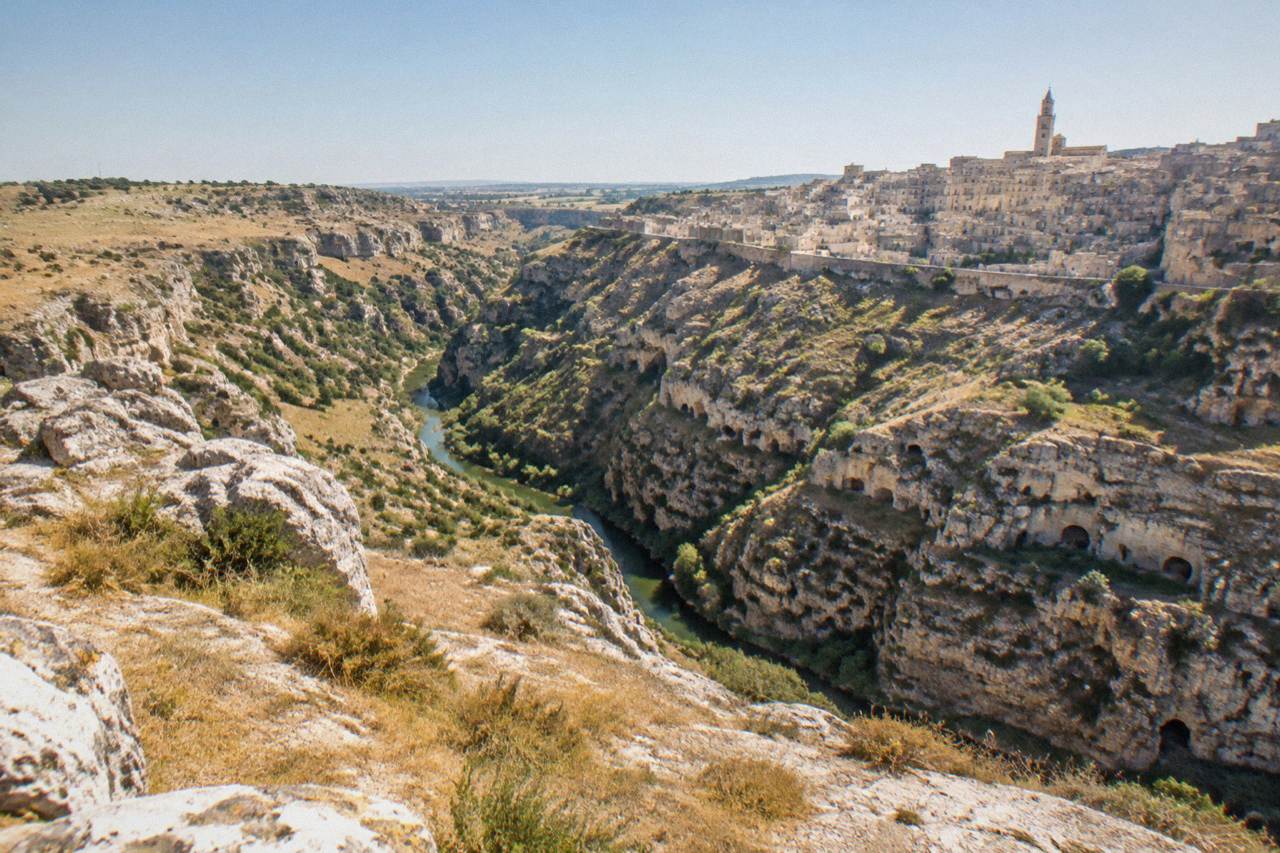
The Parco della Murgia Materana is the Archaeological Historic Natural Park of the Rupestrian Churches of Matera, created by regional law in 1990 and inscribed with the Sassi on the UNESCO World Heritage list in 1993. It covers about 8,000 hectares by the park's own count and holds the Gravina canyon, the rock-cut churches, Sentiero 406 with its suspension bridge, and the Belvedere Murgia Timone viewpoint over the Sassi.
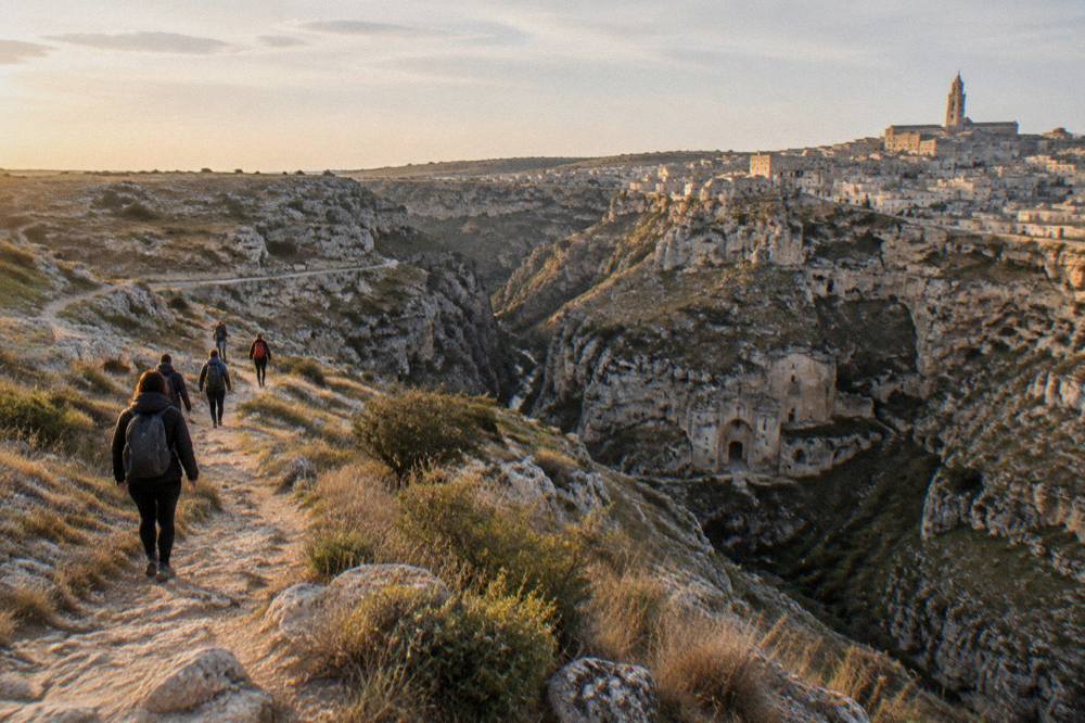
The Parco della Murgia Materana is the protected landscape that stands opposite the Sassi of Matera, in the region of Basilicata in southern Italy. Where the cave city drops into the Gravina canyon, the park begins on the other side: a plateau of pale limestone, grain fields, rupestrian churches and sheep tracks, governed by the park authority from offices inside the city itself. UNESCO inscribed the Sassi and the park together in 1993 as a single World Heritage site, and the park's own site counts 923 plant species inside its borders, about a sixth of the national flora. This guide sets out what the park is, how to reach it from the city, what the walks involve, and what has changed on the ground in 2026.
What Is The Parco Della Murgia Materana?
The Parco della Murgia Materana is the Archaeological Historic Natural Park of the Rupestrian Churches of Matera, a protected area created by Basilicata's regional Law 11 of 1990 and inscribed together with the Sassi on the UNESCO World Heritage list in 1993. It protects the plateau and canyon wall opposite the city, a landscape of rock-cut churches, cave dwellings, sinkholes and karst grassland that the UNESCO citation describes as an outstanding example of a rock-cut settlement adapted to its setting, with continuity over more than two millennia.
The park exists because the Sassi cannot be read alone. The cave city and the far side of the Gravina were one pastoral economy for centuries: the same tufa, the same water-catchment systems, the same herders moving between cave shelters on both walls of the canyon. Regional Law 11/1990 gave the far side a legal boundary and a management body, and UNESCO's 1993 inscription covered both, under the name "The Sassi and the Park of the Rupestrian Churches of Matera", site 670.
The territory is genuinely rural. Beyond the canyon rim the Murgia is bare rolling plateau, crossed by tratturi, the old drove roads for transhumant flocks, and punctuated by jazzi, the walled sheep enclosures that give the Jazzo Gattini visitor centre its name. The park's own site counts 923 plant species, about a sixth of Italy's flora, an unusually high figure for a protected area of this size and a direct result of the karst microhabitats. The rock churches are the other reason for protection: cave chapels cut into the canyon walls, painted in fresco between the medieval period and the Ottoman era, many reachable only on foot. For the churches inside the city itself, see the rupestrian churches of Matera.
| Fact | Figure | Source basis |
|---|---|---|
| Legal name | Archaeological Historic Natural Park of the Rupestrian Churches of Matera | Regional Law 11/1990 |
| Created | 1990 | Regional Law 11/1990 |
| UNESCO inscription | 1993, site 670, criteria (iii), (iv), (v) | UNESCO list |
| Size | About 8,000 hectares by the park's own count; UNESCO cites some 6,500 ha protected under Law 11/1990 | parcomurgia.it; UNESCO |
| Plant species | 923, about a sixth of the national flora | parcomurgia.it |
| UNESCO property area (Sassi and park) | 1,016 ha | UNESCO list |
How Big Is The Park And What Does It Contain?
The park covers about 8,000 hectares by the park's own count, spread across the plateau and the canyon system south and east of Matera, though UNESCO records a smaller protected figure of some 6,500 hectares under the founding law. Inside it are the Gravina canyon, dozens of rupestrian churches cut into the canyon walls, the neolithic cave sites on the plateau, the jazzo sheep enclosures, the wide grain fields of the Murgia, and the path network that includes Sentiero 406 and the suspension bridge over the Gravina.
The two size figures are not a contradiction so much as two ledgers. The park authority manages land under several instruments and quotes "circa 8000 ettari" on its own pages; UNESCO's documentation for site 670 says the 1990 law protects "some 6,500 ha". A guide that prints one bare number hides the other, so this site quotes both, with attribution.
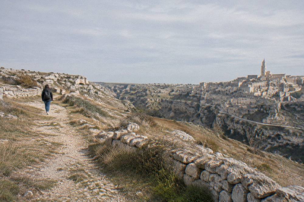
What the plateau holds, in practice, is layers. The oldest are the cave systems: the Gravina's walls were cut into for dwellings, stalls, cisterns and chapels over many centuries, and the plateau above carries the evidence of pastoral use, dry-stone walls, cistern mouths and the jazzi. The churches are the finest layer. Local tradition and park material count the rupestrian churches in the area at around 150, a figure that circulates widely, though this site has not confirmed it on an official page and repeats it only as the commonly cited number. Several of the most visited, Santa Lucia alle Malve, Madonna de Idris and San Pietro Barisano, are inside the Sassi and run by the Oltre l'Arte circuit rather than by the park, with a posted tariff of 4.50 EUR for one church, 8.00 EUR for two and 10.00 EUR for three. The park's own churches, on the far side, are mostly open terrain, unlit and unfurnished, which is exactly their appeal.
Guided products cover the Murgia side of the canyon as well as the city, and the trio below mixes the park viewpoint walks with the classic sightseeing formats.
The pairing is worth planning: a walk on the plateau in the late afternoon puts you on the rim when the Sassi catch low light across the canyon, and the viewpoints guide covers the angles in detail.
How Do You Get Into The Parco Della Murgia Materana From Matera?
The main developed access points are Jazzo Gattini, the park's visitor centre on the Matera side since 6 February 2026, which runs an info point, a ticket office and access control towards Belvedere Murgia Timone, and the Porta Pistola entrance to Sentiero 406 at the southern end of the Sassi, which since March 2026 has a staffed access point and an online access ticket. Both are reached on foot or by short transfer from the city centre; there is no verified public bus to the belvedere.
Jazzo Gattini reopened under a new concession, Società Parco Sassi Srl, on 6 February 2026, and the park's site describes it as the operational hub: information, tickets and control of the flow towards Murgia Timone. A second visitor centre, in the former convent of Santa Lucia inside the Sassi, is listed by the park as opening soon, with no date published. A third, at Montescaglioso on the far side of the plateau, serves the southern reaches of the park.
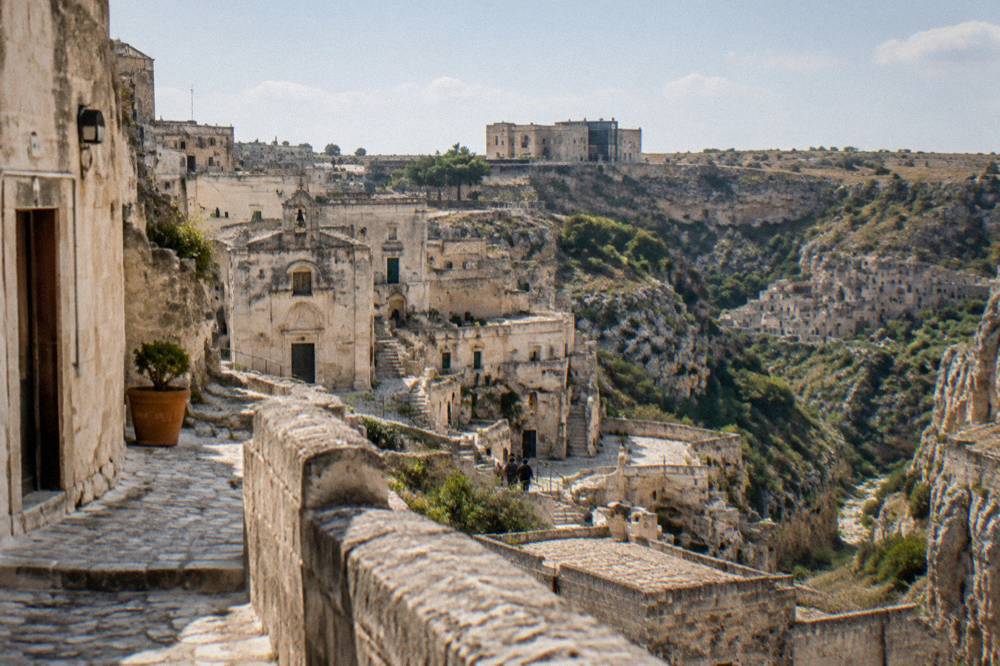
The Sassi themselves are steep, stepped and uneven, so the approach on foot from the city needs steady shoes and a little time. Access rules that matter, all from the park's own pages:
| Access point | Status | Details |
|---|---|---|
| Jazzo Gattini | Active since 6 February 2026 | Info point, ticket office, access control towards Murgia Timone |
| Sentiero 406, Porta Pistola | Staffed since March 2026 | Online access ticket; conduct rules accepted at purchase |
| Santa Lucia convent centre (Sassi) | Listed as opening soon | No opening date published |
| Belvedere Murgia Timone car limits | Reported in local news | Not confirmed by this site; check at Jazzo Gattini |
For the suspension bridge path the park now requires the access ticket bought online, with half price for visitors under 25 and free entry for residents of Matera and Montescaglioso, children under 6, and disabled visitors with a companion. The price itself is unsettled between the park's ticket page and press reports, so this site prints none of it: check the ticket page before you go. Sunset walks on the Murgia side are the most popular guided format, and the sunset tour below includes the transfer from the city, which removes the access question entirely.
If your day is fuller than that, the half-day and full-day options in the box below cover the same rim with a tour leader on board.
What Is Sentiero 406 And The Tibetan Bridge Over The Gravina?
Sentiero 406 is the path that runs along and into the Gravina canyon from the Porta Pistola entrance below the Sasso Caveoso, crossing to the plateau side by a suspension footbridge above the ravine, and it has been a managed, ticketed route with a staffed access point since March 2026. The walk gives the closest views of the canyon walls and the cave church openings cut into them, ends near the Belvedere Murgia Timone, and is entirely on uneven natural terrain.
The bridge is the park's single most photographed structure after the Sassi themselves. From its middle, the canyon opens both ways: the cave fronts of the city side, the scrub and rupestrian openings of the park side, and the sky over the plateau. The management change matters for planning. Before March 2026 the path was effectively open terrain; since then the park has run a presidio, a staffed point, and sells a ticket di accesso online, with buyers accepting the park's conduct rules at purchase. Half price applies under 25; entry is free for residents of Matera and Montescaglioso, under-6s and disabled visitors with a companion. Hours and price are seasonal and not verified by this site, so confirm both on the ticket page before setting out.
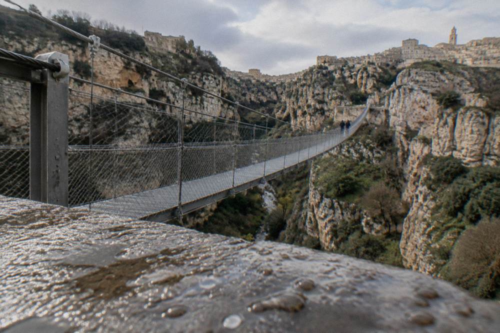
The terrain throughout is rock, steps and gravel, with no step-free sections anywhere on the route. The dedicated Tibetan bridge page carries the route in detail. If you would rather cross with a guide who handles the access ticket and the route-finding, the tour below covers the Sassi, the Murgia and the bridge in one outing.
What Can You See At Belvedere Murgia Timone?
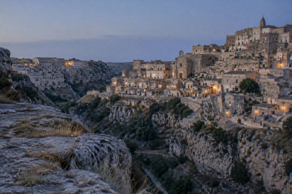
Belvedere Murgia Timone is the terrace on the park side of the Gravina that holds the classic full-frontal view of the Sassi, reached by a track from Jazzo Gattini or by the Sentiero 406 route from Porta Pistola, and it is the spot from which the postcard panorama of Matera is taken: the whole cave city stacked above the canyon, with the Cathedral on the ridge line. Access is across the bridge path or around by the plateau road.
Every photograph of Matera that shows the city from across the ravine was taken from this side. The belvedere sits on the canyon rim among juniper and rock, and the view runs the length of the Sassi: Sasso Caveoso to the left with the cliff-face churches, the Civita ridge in the middle crowned by the Cathedral, Sasso Barisano to the right. At sunset the pale stone goes gold, then rose, and the evening lights of the cave city come on below.
Reports that private cars are limited at peak times, with a shuttle from Jazzo Gattini, circulate in local news and in Grok's search results, but this site has not confirmed them on an official page, so treat them as unverified and ask at the visitor centre. What is confirmed is the visitor centre itself and its access-control role since February 2026. The walk out from the belvedere along the rim path continues towards the Neolithic cave area, where the canyon wall shows the earliest phases of use, the layer UNESCO's citation describes as first occupied during the Palaeolithic. The wider set of guides lives on Matera Travel Guide.
What Flora And Wildlife Does The Murgia Plateau Hold?
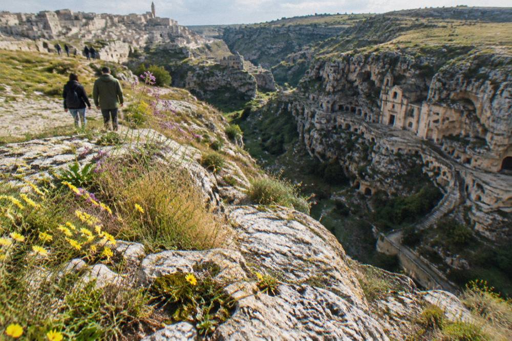
The park's own site counts 923 plant species, roughly a sixth of Italy's entire flora, across its karst grasslands, rocky steppes and canyon scrub, an extraordinary concentration for a single protected area, alongside the fauna of an open Mediterranean plateau: birds of prey over the ravine, including nesting kestrels and lesser kestrels around the Gravina, reptiles on the bare stone, and the small mammals of an extensive grazing landscape. Spring is the botanical peak, when the plateau flowers between March and May before the summer heat shuts the grassland down.
The figure is not decoration. Karst plateaus concentrate rare species because each microhabitat, a sinkhole floor, a shaded canyon wall, a patch of thin soil over limestone, carries its own conditions, and the Murgia has thousands of such patches. The lesser kestrel colony is the flagship fauna story: the small falcons nest in the cavities of the canyon walls and old buildings on both sides, and the Gravina is one of their strongholds in southern Italy. Birders should bring binoculars rather than expect hides; the park is open country, and the raptors pass at eye level along the rim.
The climate frames everything. The ERA5 reanalysis for Matera, 1991-2020, gives mean highs of 22.7 C in May but 31.2 C in July and 31.3 C in August, with July and August each seeing roughly 19 to 21 days at or above 30 C. There is no shade on the plateau in summer, none at all, and the walks that feel gentle in April are punishing at midday in August. Winter reverses the problem: frost days cluster from December to March, and the paths turn slick.
| Month | Mean high °C | Mean low °C | Rain mm | Rain days |
|---|---|---|---|---|
| Mar | 14.1 | 4.4 | 59.2 | 9.4 |
| Apr | 17.4 | 7.1 | 56.5 | 9.7 |
| May | 22.7 | 11.5 | 41.7 | 7.9 |
| Jun | 28.2 | 16.0 | 35.1 | 6.4 |
| Jul | 31.2 | 18.6 | 21.2 | 4.4 |
| Aug | 31.3 | 18.9 | 21.7 | 4.7 |
| Sep | 25.7 | 15.2 | 44.8 | 7.0 |
| Oct | 20.8 | 11.6 | 51.7 | 7.5 |
Figures are ERA5 reanalysis values for the Matera grid cell, 1991-2020, a modelled dataset rather than a station record.
When Is The Best Time Of Year To Walk In The Murgia Park?
April, May, late September and October are the strongest months for walking in the park, combining the ERA5 mean highs of 17 to 23 C in spring and 21 to 26 C in early autumn with the plateau's flowering or post-summer colour, while the APT Basilicata data shows September is Matera's busiest month for arrivals, 61,630 in 2025 against 60,257 in August, so late September and October trade slightly cooler walks for thinner crowds on the paths.
The pairing of the two datasets is the honest way to answer the question. The climate table above says the plateau is walkable from March to June and from September to early November, with a hard midsummer window. The arrivals table below says when the paths will be shared: September is the peak, with 74.5% of that month's arrivals from abroad, while February, at 15,239 arrivals, is the quietest month in the city's registered accommodation, and November is the wettest month on the ERA5 normals at 67.1 mm.
| Month (2025) | Arrivals, registered accommodation | Notes |
|---|---|---|
| Feb | 15,239 | Quietest month |
| Apr | 45,195 | Spring walking season |
| May | 54,101 | Peak botanical month |
| Aug | 60,257 | Second busiest; heat on the plateau |
| Sep | 61,630 | Busiest month; 74.5% from abroad |
| Oct | 52,538 | Cool mornings, warm afternoons |
| Nov | 23,555 | Wettest month (67.1 mm, ERA5) |
Winter walking is real but different: the Sassi and the museums absorb the short days, and a rim walk at noon in December, mean high 11.2 C, is feasible with layers. What this site's data does not support is the idea of a dead season; even February logged 15,239 arrivals in 2025.
What Should You Bring And How Should You Prepare For A Murgia Walk?
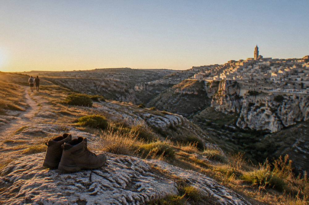
Bring closed walking shoes with grip, a litre of water per person at minimum in any season, sun protection and a wind layer, because the plateau is exposed in every direction, and bring the access arrangements already settled: the Sentiero 406 ticket bought online if you are crossing the bridge, and a check of the park's service notices for the day. There is no step-free terrain on the canyon paths, no shade on the plateau, and no water source once you leave Jazzo Gattini.
The walk is planned like open-country hiking, not like a city stroll. Footwear is the detail that decides the day. The paths run over limestone, gravel and bedrock polished by feet, and the descent into the Gravina from Porta Pistola is stepped and irregular. The Sassi side of any combined route adds cobbled stairways. The park's conduct rules, which buyers of the Sentiero 406 ticket accept at purchase, cover staying on marked paths and respecting the protected surfaces; the canyon walls hold fragile fresco fragments in the open churches, and touching them is out.
A simple readiness table, drawn from the park's own arrangements:
| Item or step | Why | Where it applies |
|---|---|---|
| Closed shoes with grip | Polished rock and gravel on every path | All canyon and rim routes |
| Water, 1 L or more | No sources beyond Jazzo Gattini | Plateau and bridge routes |
| Online access ticket | Staffed entry since March 2026 | Sentiero 406, Porta Pistola |
| Sun hat and cream | No shade on the plateau | All routes, April to October |
| Wind or fleece layer | Exposed rim, wind funnels in the canyon | Autumn to spring |
| Emergency number 112 | Single European number, live in the Matera district since 2 December 2025 | Everywhere |
Mobile coverage on the plateau is patchy in the canyon itself, so settle the meeting point and the return route before you set out.
How Does The Park Fit Into A Wider Matera Itinerary?
The park works best as the second half of a two-day plan: the first day inside the Sassi, the cave houses and the casa grotta museums, the second afternoon on the plateau for the bridge walk and the belvedere at sunset, with the return across the canyon into the city for dinner.
From Matera, the park's own towns and the wider region sit within an hour or two by road: Montescaglioso 19 km, the Crypt of the Original Sin 13 km, Altamura 20 km and Alberobello 68 km, each a separate half-day or full-day trip.
The casa grotta museums inside the city are covered in their own guide, and they pair naturally with a park day, since both sides of the canyon tell one story of cave dwelling. The road distances below are computed free-flow times from Matera Centrale, without traffic, and are rounded; treat them as planning figures, not promises.
| Destination | Road km | Free-flow drive time |
|---|---|---|
| Crypt of the Original Sin (ticket office) | 13 | About 20 minutes |
| Montescaglioso | 19 | About 25 minutes |
| Altamura | 20 | About 20 minutes |
| Craco | 57 | About 1 hour |
| Bari Airport | 64 | About 1 hour |
| Alberobello | 68 | About 1 h 25 |
| Polignano a Mare | 100 | About 1 h 30 |
Two of these pair naturally with the park. The Crypt of the Original Sin, a painted rock church on a farm track south of the city, belongs to the same rupestrian world as the Murgia churches, and its own page covers the mandatory e-ticket booking. Alberobello, the trulli town in Puglia, makes the classic counterpoint: cave city in the morning, cone-roofed town in the afternoon. The related tour on this page is exactly that format, a guided walk of Alberobello's trulli districts, and its live listing carries the current price and dates.
You can also check availability directly: Check availability, or pair it with the wider things to do in Matera index for the city days.
What Has Changed In The Parco Della Murgia Materana Recently?
The park has changed more in 2026 than in the previous decade: Jazzo Gattini reopened as the staffed visitor centre and ticket office on 6 February 2026, Sentiero 406 and its bridge moved to managed, ticketed access from March 2026, and the park's listing now includes a further visitor centre in the Sassi marked as opening soon, all confirmed on the park's own pages. At the same time the UNESCO listing itself is unchanged since 1993, and the park's size, flora count and founding law all stand as they were.
The direction of travel is clear: the open plateau is becoming a managed site, with tickets, staffed gates and a visitor-centre network, while the number of confirmed, printable facts, prices and hours above all, stays deliberately thin. This site reports only what the park's own pages state, and flags the rest as unconfirmed.
If the park day is one item on a longer southern-Italy plan, the formats below cover the city, the canyon rim and the trulli country in guided form, with cancellation terms on the operator's live listing.
Common Questions About The Parco Della Murgia Materana
Is the Parco della Murgia Materana free to enter?
The plateau's open areas and the Belvedere Murgia Timone rim have no entry charge that this site can confirm, but Sentiero 406 and the suspension bridge have required an online access ticket since March 2026, sold through the park's ticketing site. Under-25s pay half price; residents of Matera and Montescaglioso, children under 6 and disabled visitors with a companion enter free. The exact price and seasonal hours are not verified by this site: check the ticket page before you go.
Can you walk from the Sassi to the Murgia park without a car?
Yes. The Porta Pistola entrance to Sentiero 406 sits at the southern end of the Sasso Caveoso, below the Sassi, and the route crosses to the park side on the suspension bridge. Jazzo Gattini, the visitor centre, is on the plateau road a short transfer from the centre. There is no public bus to the belvedere that this site can verify; reports of a shuttle from Jazzo Gattini are unconfirmed, so ask at the visitor centre.
Is the Tibetan bridge walk difficult?
The route is graded as a moderate country walk rather than a via ferrata, but it is entirely on natural terrain: rock, steps and gravel, with uneven ground throughout and no step-free sections. The bridge itself is a wire suspension footbridge over the Gravina. Closed shoes with grip are needed, and the park's conduct rules apply, accepted when the access ticket is bought.
How long does a Murgia park visit take?
Plan on two to three hours for the Sentiero 406 crossing and the belvedere, longer if you continue along the rim towards the Neolithic cave area, and around two and a half hours for the guided sunset formats that include the transfer from the city. Product durations for specific tours render on their own listings and are not restated here.
Where is the classic view of Matera from?
From Belvedere Murgia Timone, on the park side of the Gravina, where the full front of the Sassi is visible across the canyon with the Cathedral on the ridge. It is the vantage point for the standard panorama of the city and is best in the last hours of daylight.
Is the Murgia park the same UNESCO site as the Sassi?
Yes. UNESCO inscribed "The Sassi and the Park of the Rupestrian Churches of Matera" as one World Heritage property, site 670, in 1993, under criteria (iii), (iv) and (v), covering 1,016 hectares of property that spans both sides of the Gravina.