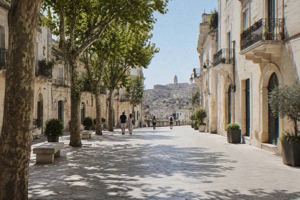
Where Is Matera
Matera is an inland city in the region of Basilicata, southern Italy, about 400 m above sea level on the edge of the Gravina canyon, opposite the Murgia plateau, with no sea of its own and the coast a day trip away.
Short answer
Matera is a city and comune in Basilicata, southern Italy, the capital of the province of Matera, about 400 m above sea level on the edge of the Gravina canyon. It is roughly 64 km by road from Bari Airport and 68 km from the city of Bari, in the neighbouring region of Puglia.
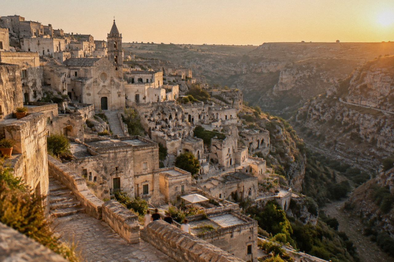
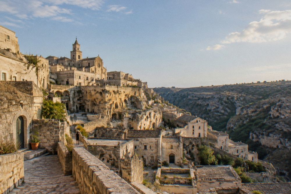
Matera is an inland city in the region of Basilicata, southern Italy, about 400 m above sea level on the edge of the Gravina canyon, with the Murgia plateau rising on the opposite side of the ravine. It is the capital of the province of Matera, and the comune counted 59,368 residents on 1 January 2026 according to ISTAT figures published via tuttitalia.it. There is no sea at Matera: the coast is a day trip, whether Metaponto on the Ionian or Polignano a Mare, Monopoli and Bari on the Adriatic. What made the city famous is the Sassi, the two old quarters of Sasso Caveoso and Sasso Barisano, where cave dwellings, stone houses and rock-hewn churches are cut into pale tufa limestone, a settlement UNESCO inscribed on the World Heritage List in 1993.
That one-paragraph answer settles the geography, but the question "where is Matera" keeps being asked because the city sits in a corner of Italy that travellers often misplace. It is not in Puglia, it is not on the water, and it is not on the national rail network, three facts that trip up a surprising number of itineraries. This guide from the Matera Travel Guide editorial desk lays out the location precisely, using only figures the desk could verify on official or primary sources.
Where Is Matera, Exactly?
Matera is a city and comune in southern Italy, in the region of Basilicata, and it is the capital of the province of Matera, standing on the edge of the Gravina canyon at about 400 m above sea level with the Murgia plateau facing it across the ravine. The comune covers 392.08 square kilometres, had 59,368 residents on 1 January 2026 by the ISTAT count, and carries a density of 151.42 residents per square kilometre, with phone prefix 0835 and postcode 75100.
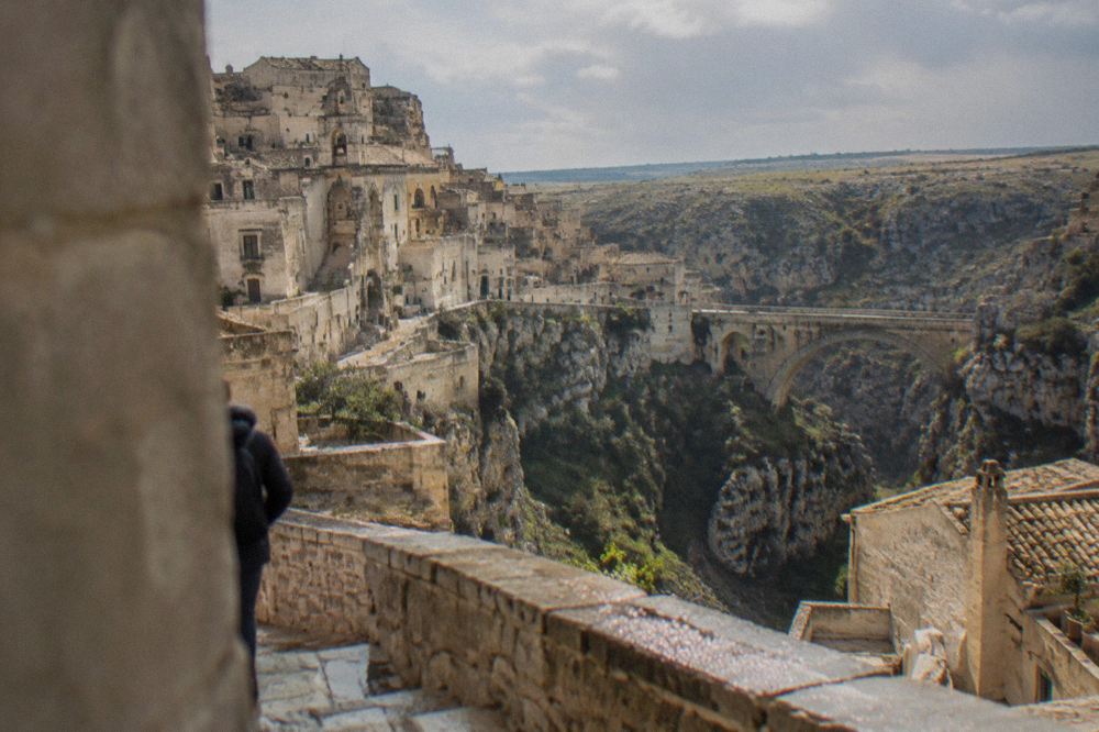
Sources differ on the exact elevation: 406 m at the town hall by the ISTAT-based tuttitalia figure, 401 m in some gazetteer entries. This site prints only "about 400 m". The municipal territory itself ranges from 49 m to 520 m, dropping into the Gravina and climbing onto the plateau. The canyon is not decoration; it is the reason the city exists in this form. The Sassi were hollowed into the canyon wall where soft tufa could be cut with hand tools, and the Parco della Murgia, about 8,000 hectares by the park's own count, protects the rupestrian churches scattered across the plateau opposite.
The city's identity in brief: region Basilicata, ISTAT code 077014, currency the euro, language Italian, Italy a Schengen member. Residents are called materani. The patron feast is the Festa della Bruna, held every 2 July, a date the organisers trace back to 1389.
| Item | Value |
|---|---|
| Country and region | Italy, Basilicata (not Puglia) |
| Province | Matera, of which it is the capital |
| Elevation | About 400 m above sea level (sources differ: 401 to 406 m) |
| Municipal area | 392.08 km² |
| Residents, 1 Jan 2026 | 59,368 (ISTAT via tuttitalia.it) |
| Postcode, phone prefix | 75100, 0835 |
| Emergency number | 112 (single European number, live in the 0835 district since 2 December 2025) |
Is Matera In Puglia Or In Basilicata?
Matera is in Basilicata, not in Puglia: the regional boundary runs between Matera and nearly all of the famous towns travellers bundle with it, since Alberobello, Polignano a Mare, Bari, Lecce and Ostuni all sit in Puglia, the neighbouring region to the northeast. Matera is one of only two provincial capitals in Basilicata, the other being Potenza, and the drive to the border town of Altamura, already in Puglia, is just 20 km by road.
The confusion is understandable, because Matera is reached almost entirely through Puglian gateways. Bari's airport and Bari Centrale station sit in Puglia, and the classic itinerary strings Matera together with Puglian towns on either side. Basilicata is a small, mountainous region between Puglia, Campania and Calabria, with a short stretch of Ionian coast of its own around Metaponto. Matera sits in its northeast corner, hard against the Puglian border. Every practical route into Matera crosses regional lines, which is why so many guides, quite wrongly, file the city under Puglia.
The distinction matters for planning. Regional transport, regional museums and regional tourism data all come from Basilicata. When this site cites arrival figures, they are APT Basilicata accommodation counts for the city of Matera. A fuller treatment of the mix-up lives in the site's guide to whether Matera is part of Puglia, and for the region's wider pull, the Basilicata road trip itinerary shows how the geography strings together.
Because the border is so close, the classic pairing is Matera with Alberobello, 68 km away by road. The trulli town sits in Puglia's Valle d'Itria, and the Alberobello day trip guide covers the route in detail. A walk among the trulli with a local guide, bookable through the operator's live listing at Alberobello: Walking Tour among Trulli Houses with a Local, is one of the straightforward ways to see both sides of the regional line in one day: Check availability.
How Far Is Matera From Bari, Rome And The Airports?
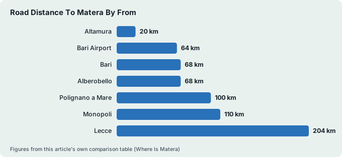
By road, Matera is 64 km and about one hour's free-flow drive from Bari Airport, and 68 km, about 1 h 02, from the centre of Bari, the region's main gateway city. From Matera Centrale station, Alberobello is 68 km (about 1 h 23), Polignano a Mare 100 km (about 1 h 29) and Lecce 204 km (about 3 h 08), all computed with the OSRM routing engine over OpenStreetMap at free-flow speed, without traffic or stops.
Planning to explore the towns around Matera at your own pace? Book a rental car here.
Bari is the working gateway. Its airport, formally Bari Karol Wojtyła, is the largest in southern Adriatic Italy, and the SS96 and SS99 roads carry traffic from there toward Matera through Altamura. There is a shuttle service of some kind between the airport and Matera, but no official timetable or fare could be verified by this desk, so nothing is printed here; the Bari Airport to Matera guide explains what is confirmed and what must be checked at booking.
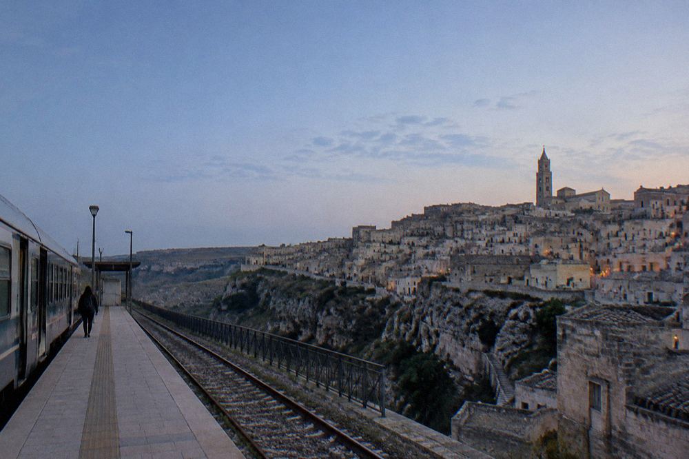
Rome and Naples connect to Matera by rail via Bari, on the FAL network described further down this page. The Rome to Matera and Naples to Matera guides break those journeys into stages. For a fuller index of routes into the city, start from how to get to Matera.
| From | Road distance to Matera | Free-flow drive time |
|---|---|---|
| Altamura | 20 km | 20 min |
| Bari Airport | 64 km | 1 h 01 |
| Bari | 68 km | 1 h 02 |
| Alberobello | 68 km | 1 h 23 |
| Polignano a Mare | 100 km | 1 h 29 |
| Monopoli | 110 km | 1 h 36 |
| Lecce | 204 km | 3 h 08 |
Drivers arriving from Bari side should also read the Matera parking guide before setting off, because the historic centre is ringed by restricted traffic zones rather than car parks, and the Matera ZTL guide lists the camera hours the comune publishes. The Sassi zone's cameras run 10:00 to 20:30 from 16 September to 30 June and 10:00 to 24:00 from 1 July to 15 September.
Once in the city, orientation is easier from above. An open-top eco-bus circuit of the Sassi runs year-round and covers the viewpoints without the climb; see the Sassi of Matera eco-bus tour page for the route description.
Is There A Beach In Matera?
No, there is no beach in Matera: the city is inland, at about 400 m above sea level, on the edge of a limestone canyon, and the nearest sea is roughly an hour's drive away in either direction. The closest coastal options are on the Adriatic in Puglia, Polignano a Mare at 100 km (about 1 h 29) and Monopoli at 110 km (about 1 h 36), while on the Ionian side, in Basilicata's own short coastal strip, Metaponto is 47 km away, about 52 minutes by road.
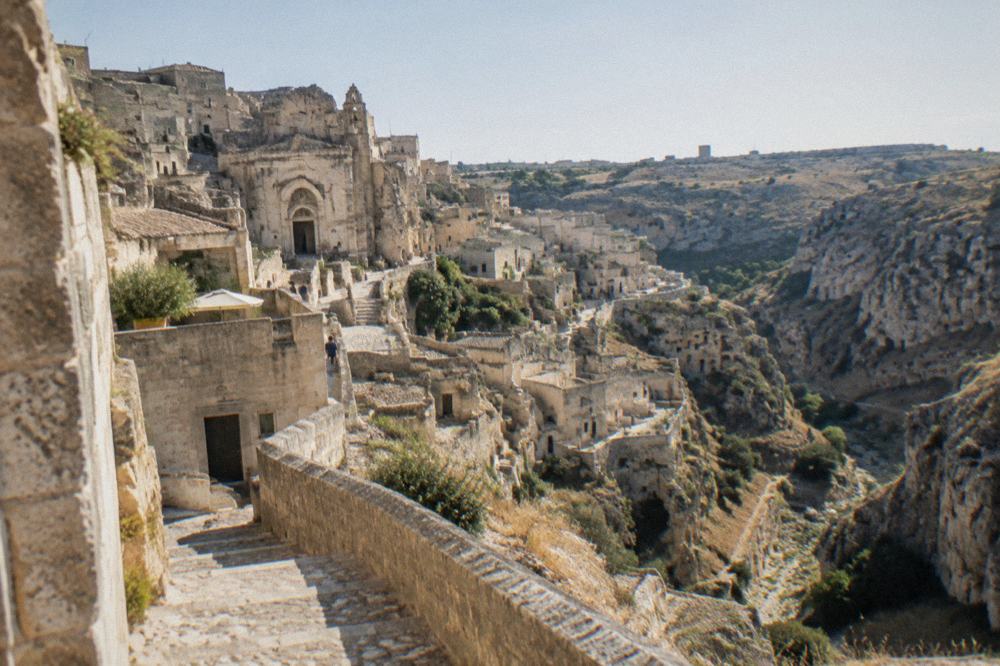
The Gravina is a canyon, not a river beach. Its stream carved the gorge that gave the Sassi their setting, and the waterless bed is crossed by the suspension bridge on Sentiero 406, reached by a managed, ticketed access point the park has staffed since March 2026. Swimming at Matera is simply not on the menu.
The sea does enter the city's cultural calendar in other ways. The exhibition "The Sea Is Closer Than You See", on contemporary art and Mediterranean culture, runs at Palazzo Lanfranchi, TAM, MUSMA and the Basilicata Open Space until 8 December 2026 as part of the Matera 2026 Mediterranean Capital of Culture and Dialogue programme. For the water itself, the beaches near Matera guide covers the coastal day trips by drive time and shoreline type.
| Coastal destination | Sea | Road distance | Drive time |
|---|---|---|---|
| Metaponto | Ionian (Basilicata) | 47 km | 52 min |
| Polignano a Mare | Adriatic (Puglia) | 100 km | 1 h 29 |
| Monopoli | Adriatic (Puglia) | 110 km | 1 h 36 |
What Is The Climate Like Where Matera Sits?
Matera's climate is a continental-leaning Mediterranean one at elevation: the ERA5 reanalysis for 1991 to 2020 gives July a mean high of 31.2 degrees Celsius and August 31.3, while January averages a mean low of 2.2 degrees with frost, and November is the wettest month at 67.1 mm of rain against July's 21.2 mm.
Across the year the grid cell records 562.5 mm of rain over about 91 rain days, figures that distinguish the canyon city sharply from the warm-winter towns on the coast.
The elevation matters. Matera at 400 m is hotter in summer and colder in winter than the Adriatic towns at sea level, and frost is normal between December and March, about 20 frost days a year. Anyone packing for the Sassi's stepped stone lanes in January should expect a real winter, covered in the site's Matera weather and what clothes to pack for Matera pages. These figures are modelled normals from a reanalysis grid cell, not a weather-station record, and are labelled as such throughout this site.
| Month | Mean high °C | Mean low °C | Rain mm | Arrivals 2025 (APT) |
|---|---|---|---|---|
| January | 10.3 | 2.2 | 51.4 | 18,402 |
| April | 17.4 | 7.1 | 56.5 | 45,195 |
| July | 31.2 | 18.6 | 21.2 | 43,966 |
| September | 25.7 | 15.2 | 44.8 | 61,630 |
| November | 15.5 | 7.5 | 67.1 | 23,555 |
The arrivals column carries the surprise: September, not August, is the busiest month. In 2025, Matera's registered accommodation logged 61,630 arrivals in September against 60,257 in August, and 74.5 percent of those September arrivals came from abroad. The best time to visit Matera guide unpacks the seasonality month by month.
How Do You Get To Matera Without A Car?
Matera is reached by rail on the FAL network, Ferrovie Appulo Lucane, with a change at Altamura on the way from Bari and a journey time of about 1 h 45 to 2 h, because there is no Trenitalia station in Matera at all. The main stop is Matera Centrale, and Bari to Matera sits in fare band 70 of FAL's 2026 fare matrix. No trains run on Sundays and public holidays, when FAL substitutes buses, eight arrivals and eight departures at Matera Centrale on the posted festive sheet.
That is the part of the geography that catches people out. Matera appears on national maps as a provincial capital, yet the national rail system stops short of it. RFI, the national infrastructure operator, is building the Ferrandina to Matera La Martella link, 20 km of new single-track electrified line at a cost of 525 million euros, with activation planned for 2028. Until then, FAL is the only rail option, and FAL's own timetable page is the place to read the live times, since service notices change the programme; from 12 October 2026, for instance, FAL replaced two early trains between Matera Sud and Altamura with buses.
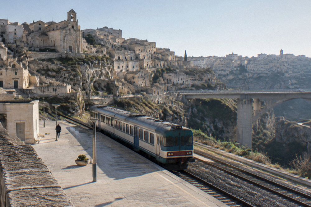
Arriving from Bari by train is covered step by step in the Bari to Matera guide, and the station itself, along with the other four Matera stops on the line, in the Matera train station page. Within the city, the terrain does the work: the Sassi are steep, stepped and uneven, and no named route through them is step-free. The getting around Matera guide says what that means in practice, and the Matera accessibility page covers the terrain honestly.
For visitors based in Bari without a car at all, an organised excursion is the other main route in. The From Bari excursion to Matera by bus pairs the transfer with a guide through the Sassi, and the Matera day trip from Bari page compares the DIY and guided options.
What Towns Are Close To Matera?
The nearest sizeable towns to Matera are Montescaglioso at 19 km, Altamura at 20 km and Miglionico at 21 km by road, with Gravina in Puglia at 30 km just across the regional line, and the drive times run from 20 to 31 minutes on free-flow roads.
Further out lie the marquee names of the neighbouring region, Alberobello at 68 km, Polignano a Mare at 100 km and Lecce at 204 km, while Craco, the abandoned hill town, is 57 km away and the Castelmezzano and Pietrapertosa pair in the Lucanian mountains 79 to 82 km out.
The immediate ring of towns is low-key and limestone-built. Altamura is famous for its bread rather than its views, Gravina for its own gorge, Montescaglioso for a grand Benedictine abbey. These are short hops, each under half an hour of driving, and the site carries dedicated guides to Altamura, Gravina in Puglia and Montescaglioso.
| Town | Road km | Drive time | Notes |
|---|---|---|---|
| Montescaglioso | 19 | 26 min | Basilicata |
| Altamura | 20 | 20 min | Puglia |
| Miglionico | 21 | 26 min | Basilicata, castle |
| Gravina in Puglia | 30 | 31 min | Puglia, gorge town |
| Craco | 57 | 58 min | Basilicata, abandoned town |
| Alberobello | 68 | 1 h 23 | Puglia, trulli |
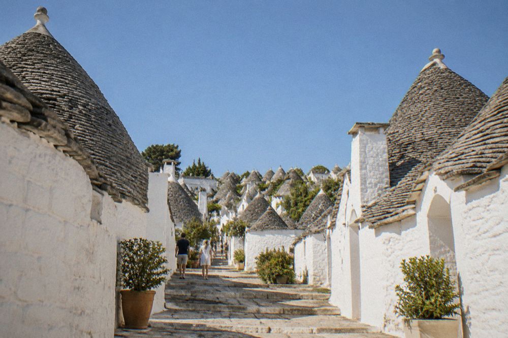
For the trulli country specifically, a second guided option runs as a compact two-hour walk through Alberobello itself, described on the Alberobello trulli tour page; the Matera and Alberobello in one day guide covers whether the pairing is realistic by train and car.
Why Do Travellers Misplace Matera On The Map?
Travellers misplace Matera for three verifiable reasons: it is the only stop on most Puglia itineraries that is not actually in Puglia, it has no national rail connection despite being a provincial capital, and its fame rests on an inland canyon setting that many people picture as coastal. UNESCO's 1993 inscription, covering the Sassi and the Park of the Rupestrian Churches across 1,016 hectares, made the city a headline destination without moving it any closer to the sea.
The city's own history deepens the disorientation. The Sassi were evacuated between 1952 and the 1970s after decades in which the cave dwellings symbolised rural poverty, the episode behind the city's old "shame of Italy" label, and a 1986 law opened the way to restoration. Today the caves house hotels and restaurants rather than overcrowded homes, and the history of Matera and do people still live in the Sassi pages cover the arc. Film reinforced the imagery: The Passion of the Christ, The Nativity Story, Wonder Woman and No Time to Die all shot here, and the James Bond filming locations guide maps the scenes.
UNESCO's own wording credits the site with "continuity over more than two millennia" and occupation from the Palaeolithic, which is the phrasing this site uses in place of the age superlatives other guides print. For where the crowds actually fall, the APT Basilicata data shows 479,083 arrivals in registered accommodation in 2025, up 23.4 percent on the 2019 Capital of Culture year, with a short average stay of 1.56 nights, a figure that explains why so many visitors see Matera as a day stop on a Puglia route.
Common Questions About Where Matera Is
Where is Matera?
Matera is an inland city in southern Italy, in the region of Basilicata, on the edge of the Gravina canyon at about 400 m above sea level. It is the capital of the province of Matera and had 59,368 residents on 1 January 2026.
Is Matera in Puglia or Basilicata?
Matera is in Basilicata. Alberobello, Bari, Polignano a Mare, Lecce and Ostuni are in Puglia, the neighbouring region to the northeast. The regional boundary runs about 20 km from Matera's centre, just beyond Altamura.
Is Matera near the sea?
No. Matera has no coast. The nearest seaside towns are Metaponto on the Ionian at 47 km, and Polignano a Mare at 100 km and Monopoli at 110 km on the Adriatic, all day-trip distances by car.
How far is Matera from Bari?
By road, Matera is 68 km from central Bari, about 1 h 02 free-flow, and 64 km from Bari Airport, about 1 h 01. By train on the FAL network the journey takes about 1 h 45 to 2 h with a change at Altamura.
Which airport do you fly into for Matera?
Bari Airport, 64 km away by road, is the practical gateway. The site's Bari Airport to Matera guide covers the transfer options; shuttle timetables and fares are not verified on any official page, so confirm at booking.
Does Matera have a train station?
Yes, Matera Centrale, on the FAL network. There is no Trenitalia service: FAL trains from Bari change at Altamura, and no trains run on Sundays and public holidays, when FAL runs replacement buses instead.
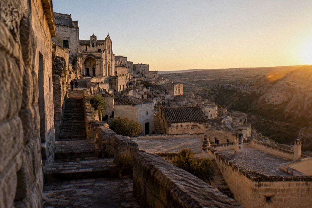
With the map settled, the natural next reads are things to do in Matera for the city itself, where to stay in Matera for the neighbourhoods, and, for a first walk through the canyon city, the Sassi di Matera guide. A cave-house walk with a licensed guide, bookable through the operator's live listing on the Sassi tour with cave house and rupestrian church page, is a sound way to anchor the geography underfoot: Check availability.
Placed correctly, Matera stops being a detour and becomes the inland anchor of a southern loop: two days in the canyon city, then outward through Basilicata or across into Puglia, with the drive times in the tables above doing the planning work.