Matera Hiking
Matera, in Basilicata in southern Italy, is one of the few European cities where a serious canyon walk begins at the edge of the old town. This guide covers the Gravina, the Murgia park paths and the hill-country day hikes within reach of the Sassi.
Short answer
The main hiking at Matera is the Parco della Murgia Matana opposite the Sassi: the Sentiero 406 path to the suspension bridge over the Gravina, the Belvedere Murgia Timone viewpoint and the park's staffed access points. Access to Sentiero 406 is ticketed and staffed since March 2026; the price and seasonal hours are not published consistently, so confirm on the park's site.
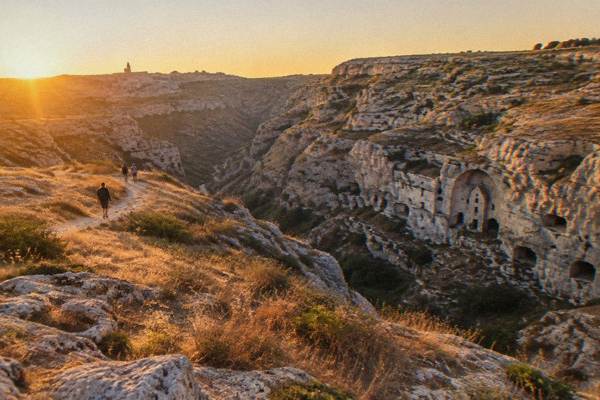
Matera, in the region of Basilicata in southern Italy, is an inland city at about 400 m above sea level standing on the edge of the Gravina canyon, with the Murgia plateau rising on the far side. That geography is what makes hiking here unusual: the trailhead is not a drive out of town but the lip of a limestone gorge directly opposite the Sassi, the cave-quarter World Heritage site inscribed by UNESCO in 1993. One side of the canyon is a city; the other side is a protected park of rupestrian churches, rock-cut shelters and scrubby plateau, about 8,000 hectares by the park's own count (UNESCO records some 6,500 ha protected under regional Law 11/1990). This guide lays out what the verified sources say about walking it: the managed access to Sentiero 406 and its suspension bridge, the viewpoints, the season-by-season climate from the ERA5 reanalysis, and the hill-country hikes within a short drive of the city.
Where Can You Hike Directly From Matera?
The walking country at Matera is the Parco della Murgia Matana, the protected plateau directly across the Gravina canyon from the Sassi, plus the canyon floor itself and the stepped lanes of Sasso Caveoso and Sasso Barisano on the city side. The park, created by regional Law 11/1990 and part of the UNESCO inscription "The Sassi and the Park of the Rupestrian Churches of Matera", holds rock-cut churches cut into the tufa and about 923 plant species by the park's own count, roughly a sixth of the national flora. No bus or car is strictly needed to reach the canyon edge: the paths drop from the city streets toward the Gravina, crossable on foot where the park's managed access allows.
The practical starting points the sources name are three. On the city side, Piazza San Pietro Caveoso sits at the edge of Sasso Caveoso and looks straight across at the opposite cliff, and from there the old paths descend toward the canyon floor. On the park side, the Jazzo Gattini visitor centre, active since 6 February 2026 under a new concession (Società Parco Sassi Srl), works as the park's info point and ticket office and controls access towards Murgia Timone, the plateau viewpoint. The third is Porta Pistola, the access point for Sentiero 406, the path with the suspension bridge over the Gravina.
The park's own site states the access regime plainly: since March 2026 Sentiero 406 has a staffed access point and an online access ticket, and buyers accept the park's conduct rules at purchase. Half price applies under 25, and entry is free for residents of Matera and Montescaglioso, children under 6 and disabled visitors with a companion. The price itself is not settled between the park's ticket page and press reports, and the seasonal hours are not published consistently: confirm both on the park's site before setting out.
For the city-side ground, the Sassi of Matera guide covers the stepped terrain, and the self-guided walking route strings the lanes and viewpoints together. Tip-based walking tours also run locally; confirm arrangements directly with the guide.
What Is The Sentiero 406 And The Suspension Bridge Over The Gravina?
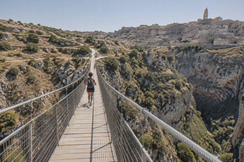
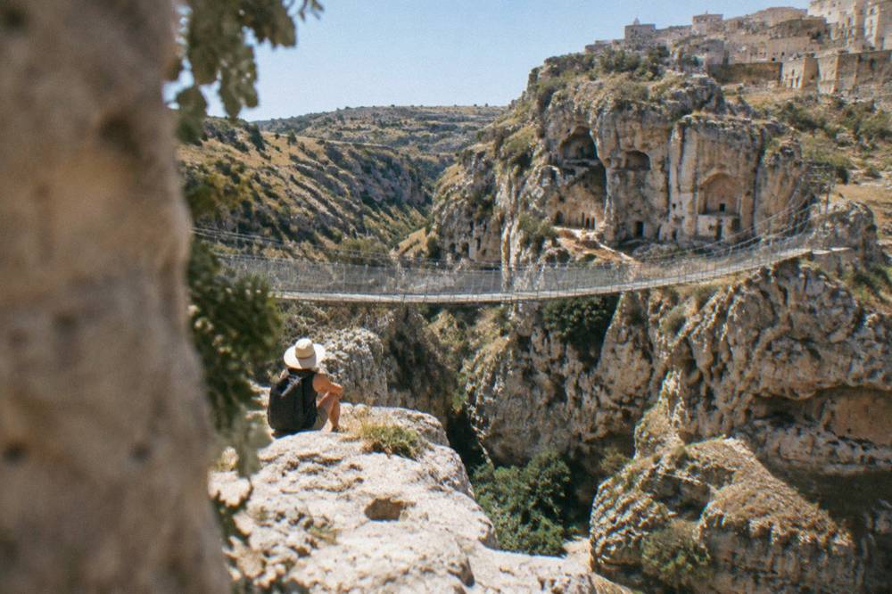
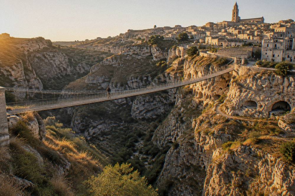
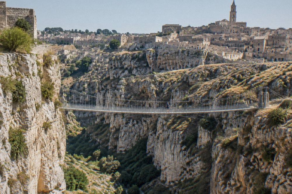
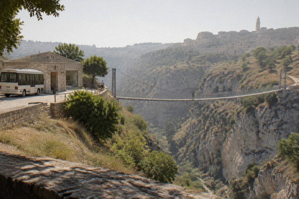
Sentiero 406 is the park path that runs down into the Gravina canyon from the Porta Pistola side and includes a suspension bridge slung across the gorge, and since March 2026 its access is managed: a staffed point checks tickets bought online through the park's system. The park announced the staffed access on 5 March 2026 and sells the access ticket through its own ticketing page; visitors accept the park's conduct rules as part of the purchase. Half price under 25; free for residents of Matera and Montescaglioso, under-6s and disabled visitors with a companion.
To walk the canyon and the bridge with a guide, book a guided Murgia hike here.
The old assumption that the bridge walk is free and unmanaged no longer holds, and older print guides still say so. The park's ticket page and press reports give conflicting prices, so this site prints none: read the live ticket page before you go. What is verified is the regime, not the tariff.
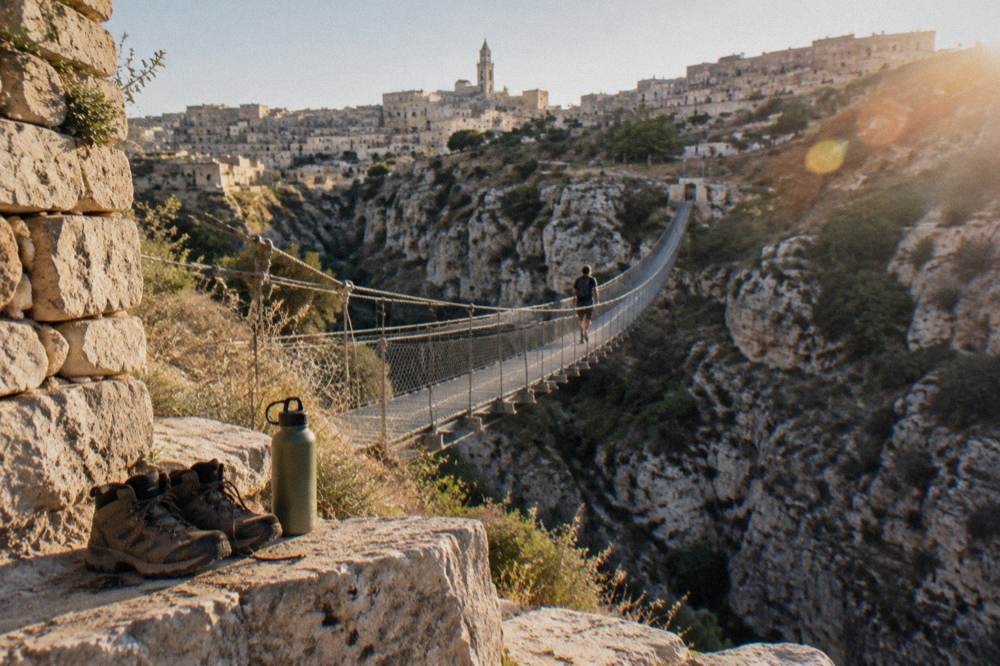
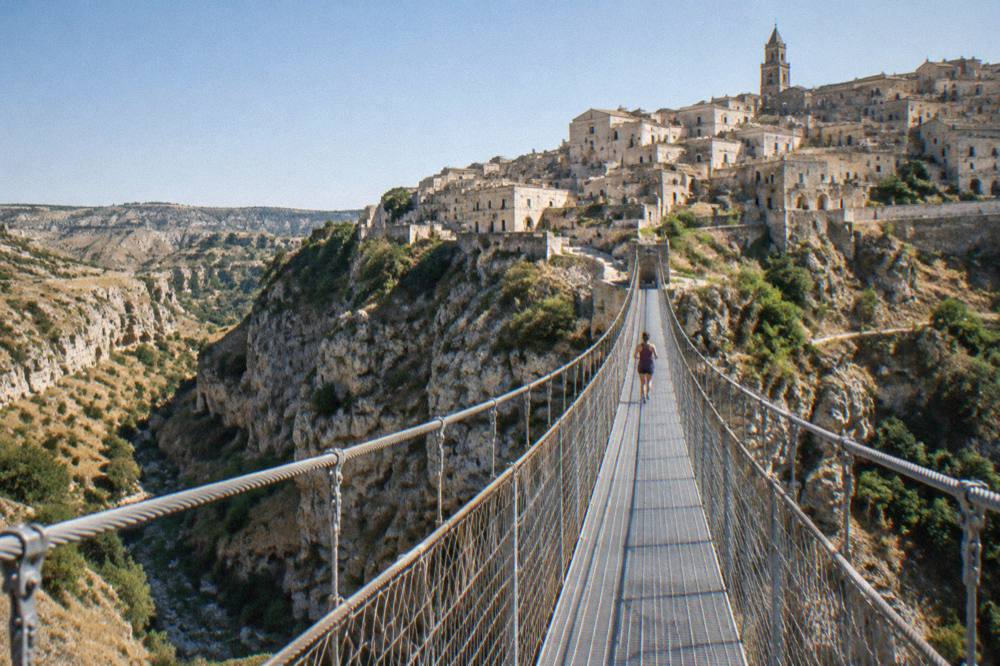
The terrain deserves respect in both directions. The path drops from the plateau into the canyon, crosses the bridge, and the return is a climb back up stepped and uneven ground under southern sun. The Sassi and the park paths are steep, stepped and uneven throughout; no named route here can be described as step-free or wheelchair accessible, and this site never describes one as such. In summer the canyon floor holds heat late into the evening, and water points on the plateau are not reliably marked: carry what you need.
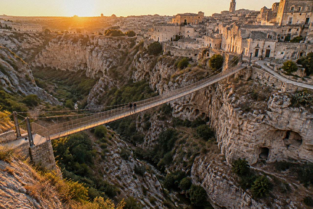
The bridge view is the canonical Matera photograph, the caves of Sasso Caveoso stacked above the gorge. The Tibetan bridge guide and the Belvedere Murgia Timone guide cover the access details, the viewpoint and the current rules, and the Parco della Murgia guide collects the whole park in one place.
When Is The Best Season For Matera Hiking?
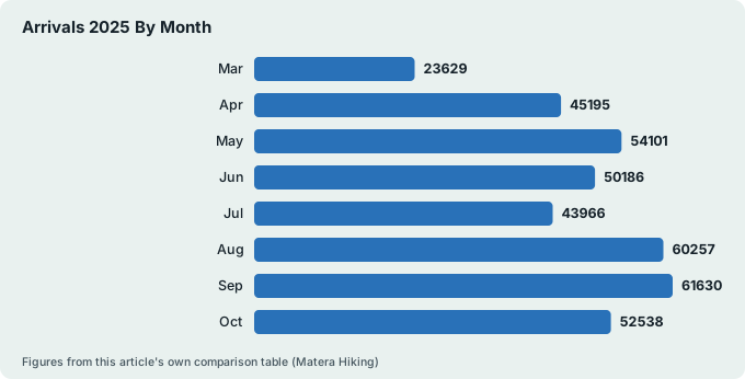
The best hiking months at Matera by climate and by crowding are April, May, October and early June: the ERA5 reanalysis 1991-2020 gives mean highs of 17.4 C in April, 22.7 C in May, 28.2 C in June and 20.8 C in October, against 31.2 C in July and 31.3 C in August, and the APT Basilicata data shows the city's accommodation logging 61,630 arrivals in September 2025, the peak month, against 15,239 in February. September, not August, is Matera's busiest month, a correction this site makes wherever crowding comes up.
The climate is continental-leaning Mediterranean at elevation: hot dry summers, cold damp winters with frost. The reanalysis counts about 55 days a year reaching 30 C, of which 19.4 fall in July and 20.9 in August, and about 20 frost days a year, almost all December to March. November is the wettest month at 67.1 mm of rain and July the driest at 21.2 mm. Rain days of 1 mm or more run 9.7 in April against 4.4 in July, so spring walks carry a real, if modest, shower risk.
| Month | Mean high C | Mean low C | Rain mm | Rain days | Arrivals 2025 |
|---|---|---|---|---|---|
| Mar | 14.1 | 4.4 | 59.2 | 9.4 | 23,629 |
| Apr | 17.4 | 7.1 | 56.5 | 9.7 | 45,195 |
| May | 22.7 | 11.5 | 41.7 | 7.9 | 54,101 |
| Jun | 28.2 | 16.0 | 35.1 | 6.4 | 50,186 |
| Jul | 31.2 | 18.6 | 21.2 | 4.4 | 43,966 |
| Aug | 31.3 | 18.9 | 21.7 | 4.7 | 60,257 |
| Sep | 25.7 | 15.2 | 44.8 | 7.0 | 61,630 |
| Oct | 20.8 | 11.6 | 51.7 | 7.5 | 52,538 |
| Nov | 15.5 | 7.5 | 67.1 | 8.3 | 23,555 |
Two readings of that table matter for walkers. July is as hot as August yet drew fewer arrivals in 2025 (43,966 against 60,257), so midsummer mornings on the plateau can be quieter than the August Italian holiday period. And 74.5 percent of September 2025 arrivals came from abroad, the year's highest foreign share: the busy shoulder season is largely international. The full picture is in the Matera weather guide and the best time to visit guide.
Winter walking is real but different: the Matera in winter guide covers the short days (9.6 hours of daylight in January against 15.0 in June, ERA5 reanalysis) and the frost. Snow is rare and light; the question is answered in full on its own page.
What Should You Wear And Carry On The Gravina And Murgia Paths?
Stout shoes with grip, a litre or more of water per person outside winter, sun protection and layers for the wind on the plateau are the standing kit for Matera hiking, because the terrain is stepped, uneven limestone and the exposure is open scrubland, not shade forest. The park's conduct rules, which access-ticket buyers accept, govern behaviour on the managed paths; the rules page sits on the park's own site. This site prints no route distances or walking times that the verified pack does not give.
Season by season, from the ERA5 reanalysis 1991-2020:
| Season | Mean high / low C | Rain | Kit emphasis |
|---|---|---|---|
| Spring (Mar-May) | 14.1-22.7 / 4.4-11.5 | 41.7-59.2 mm a month | Layers, rain shell, water |
| Summer (Jun-Aug) | 28.2-31.3 / 16.0-18.9 | 21.2-35.1 mm a month | Early start, hat, extra water |
| Autumn (Sep-Nov) | 15.5-25.7 / 7.5-15.2 | 44.8-67.1 mm a month | Rain shell, grippy shoes |
| Winter (Dec-Feb) | 10.3-11.2 / 2.2-3.7 | 51.4-57.2 mm a month | Warm layers, short-day timing |
Two terrain notes repeat across every verified description of the area. First, the canyon paths and the Sassi lanes share the same stone steps, worn and irregular, and wet limestone is slick: after rain, allow more time and treat descents carefully. Second, the plateau is open country with no reliable shade; the reanalysis puts July and August mean highs above 31 C, and canyon walls hold that heat after sunset. Start early in summer, and take the Matera travel tips guide for the general packing picture.
Mobile coverage in the canyon bottom is patchy in places, as it is in any gorge. The single European emergency number 112, free, with automatic location and multilingual support, has served the Matera 0835 district since 2 December 2025; the fire service's own notice confirms the switchover. That is the number to call, not 113 or 118.
Which Hill-Country Hikes Are Within A Drive Of Matera?
The verified walking country within easy reach of Matera is the Lucanian badlands and hill towns to the south and west: Craco, the abandoned hill town, is 57 km and about 58 minutes' drive; Castelmezzano is 82 km and about 1 h 23; Pietrapertosa, its ridge-path neighbour, is 79 km and about 1 h 22; and Montescaglioso, whose residents get free park access, is 19 km and about 26 minutes. These are free-flow driving times computed over OpenStreetMap routing, round to the quarter hour in practice, and exclude traffic, stops and parking.
| Destination | Road km from Matera Centrale | Drive time |
|---|---|---|
| Montescaglioso | 19 | 26 min |
| Altamura | 20 | 20 min |
| Miglionico | 21 | 26 min |
| Gravina in Puglia | 30 | 31 min |
| Craco | 57 | 58 min |
| Metaponto | 47 | 52 min |
| Pietrapertosa | 79 | 1 h 22 |
| Castelmezzano | 82 | 1 h 23 |
Craco is the headline hike: a ghost town abandoned after landslides, on a spur above badlands, visited on managed access only, with its own guide page. The twin villages of Castelmezzano and Pietrapertosa, in the Dolomiti Lucane, hold the ridge paths between them; see Castelmezzano and Pietrapertosa. Neither is walkable from Matera, and the pack gives no public-transport option for either: a car or an organised day trip is the practical answer.
If you would rather not drive the badlands roads yourself, two of the three products below handle the logistics. The Alberobello trip with private transfer pairs a guided walk among the trulli with door-to-door transport, and the Craco day trip adds an Amaro Lucano tasting to the ghost town. For the canyon walks inside the park, guided sunset options cover the Murgia Timone side with transfer included.
The pasta class in the list below is the rest-day counterweight: a hands-on session in an ancient wine cellar in the Sassi, which pairs naturally with a two-walk weekend.
Can You Combine A Matera Hike With Rock Churches And Cave Sights?
Yes, and it is the natural pairing: the park paths pass the same rupestrian church landscape that made the UNESCO listing, and on the city side the Oltre l'Arte ticket ladder prices one rupestrian church at 4.50 EUR, two at 8.00 EUR and three at 10.00 EUR, with reduced rates of 3.50 / 5.50 / 7.50 EUR and free entry for children up to 10 with a parent. Those churches, Santa Lucia alle Malve, Madonna de Idris with San Giovanni in Monterrone, and San Pietro Barisano, sit at or near the Sasso Caveoso edge where the canyon paths begin.
Oltre l'Arte's ticket page gives the hours in force from 28 March 2026: Santa Lucia alle Malve and Madonna de Idris daily 09:30 to 19:30 (last entry 19:20), San Pietro Barisano daily 10:00 to 19:00 (last entry 18:50). All its sites close on 25 December and 2 July, the Festa della Bruna day, when the whole city is given over to the feast. Individual churches have their own pages: Santa Lucia alle Malve, Santa Maria de Idris and San Pietro Barisano.
| City-side sight | Ticket | Hours (in force from dates shown on operator pages) |
|---|---|---|
| Oltre l'Arte rupestrian churches (each additional church) | 4.50 / 8.00 / 10.00 EUR for 1 / 2 / 3 | From 28 Mar 2026, daily 09:30-19:30 (two churches); San Pietro Barisano 10:00-19:00 |
| Storica Casa Grotta di Vico Solitario | 8.00 EUR full, 5.00 reduced, 3.00 ages 11-18 | Tariff from 4 Apr 2026; seasonal hours on casagrotta.it |
| MUSMA sculpture museum, Sasso Caveoso | 10 EUR full, 5 or 7 EUR reduced | Apr-Sep 10:00-20:00; Oct-Mar 10:00-18:00 |
| Museo Nazionale, Palazzo Lanfranchi | 10.00 EUR; 15.00 EUR cumulative 2-day | Mon-Sun 09:00-20:00 |
The Casa Grotta di Vico Solitario, the reconstructed cave house on the Caveoso lane that doubles as a museum of domestic cave life, is covered in detail on its own guide page. Casa Noha, the FAI interpretation centre that usually explains the Sassi story to newcomers, is closed 5 to 22 October 2026 for renovation ahead of a relaunch, and the Museo Ridola has been closed since 7 April 2025: plan around both.
How Do You Get To The Trailheads Without A Car?
Matera's trailheads on the canyon edge are reached on foot from the Sassi, so no transport is needed for the Gravina and Murgia Timone walks; for the hill-country hikes a car is the practical option, and Matera's rail link, FAL from Bari with a change at Altamura in about 1 h 45 to 2 h, serves the city rather than the mountains. There is no Trenitalia station in Matera. On Sundays and public holidays no FAL trains run at all, and the operator runs replacement buses instead.
For the plateau side of the canyon, the park's own materials name Jazzo Gattini as the info point and ticket office controlling access towards Murgia Timone. Reports that private cars are limited at peak times near the belvedere, with a shuttle from Jazzo Gattini, come from press summaries rather than a page this site has read in full: treat them as unconfirmed and check with the visitor centre. There is no verified public bus to Belvedere Murgia Timone.
If you are arriving from Bari and want to walk the same day, the Bari to Matera guide and Bari airport to Matera guide cover the FAL detail, and the how to get to Matera guide covers the rest. FAL is changing parts of the Matera Sud to Altamura rail programme from 12 October 2026, replacing two early trains with buses, so read the live timetable rather than any cached one. Driving into the Sassi side is restricted by the ZTL camera zones: the Matera parking guide and Matera ZTL guide explain where to leave the car.
One note on distances people ask about: the coast is a day trip from Matera, not a local walk. Metaponto on the Ionian is 47 km and about 52 minutes' drive; Polignano a Mare on the Adriatic is 100 km and about 1 h 29. There is no sea at Matera, and the beaches near Matera guide addresses the question honestly.
Where Should You Stay For A Walking Weekend In Matera?
For a walking weekend, stay inside or beside the Sassi: the canyon-edge trailheads at Piazza San Pietro Caveoso and the path down toward the Gravina are minutes away on foot, and the APT Basilicata data shows guests averaged just 1.56 nights in Matera in 2025, so even one well-placed night buys two walking mornings. The cave hotels of the Sassi put you at the top of the terrain; the modern Piano above puts you level with the station and the plateau roads.
The trade-off is the terrain itself. The Sassi are steep and stepped, so a hotel low in Sasso Caveoso means a climb home every evening, luggage included. The where to stay in Matera guide, the cave hotels guide and the Sassi hotels guide set out the districts and the trade-offs quarter by quarter. Matera charges a tourist tax collected by the accommodation; the amount is confirmed at booking.
For eating, the restaurants guide and the what to eat in Matera guide cover the refuelling, and the pane di Matera, the city's PGI-registered bread, is the trail food with the longest local pedigree. A guided option that ends with food rather than starting with stairs is the full Sassi walk with a tasting, or the olive-oil temples food tour in the surrounding countryside.
Matera hiking rewards the same discipline the park now applies to its own paths: check the live rules, carry water, start early in the hot months, and treat the canyon as real terrain rather than a backdrop. The Matera Travel Guide homepage collects the walking, eating and day-trip pages in one place, and the photography spots guide marks the rims where the light lands best after the walk is done.
Common Questions About Matera Hiking
Is the walk to the suspension bridge over the Gravina free?
No. Since March 2026 Sentiero 406 has a staffed access point and an online access ticket sold through the park's ticketing system. The price is not printed here because the park's own pages and press reports conflict; check the live ticket page. Half price applies under 25, and entry is free for residents of Matera and Montescaglioso, children under 6 and disabled visitors with a companion.
How hard are the Matera and Murgia walks?
They are steep, stepped and uneven limestone terrain, climbing in and out of the Gravina canyon. No route at Matera can be described as step-free or wheelchair accessible. The ERA5 reanalysis 1991-2020 puts July and August mean highs above 31 C, which adds heat to the climbing in summer.
Do you need a guide to hike at Matera?
No for the city-side lanes and viewpoints, which are public streets and squares. The park's managed paths require the access ticket, and guided walks, including sunset options with transfer, run locally. Tip-based walks also run; confirm arrangements directly with the guide.
What is the best month for hiking in Matera?
By the ERA5 reanalysis 1991-2020, April, May and October offer mean highs of 17.4 to 22.7 C against above 31 C in July and August. November is the wettest month at 67.1 mm of rain, and winter brings about 20 frost days a year, almost all December to March.
Can you hike from Matera to the sea?
No. Matera is an inland city on the Gravina canyon; there is no sea and no coastal path. The nearest shores are day trips: Metaponto on the Ionian, 47 km and about 52 minutes' drive, or Polignano a Mare on the Adriatic, 100 km and about 1 h 29.
What number do you call in an emergency on the trails?
112, the single European emergency number, free, with automatic location and multilingual support. It has served the Matera 0835 district since 2 December 2025, when the district joined the unified system.